
Typhoon Haiyan
Typhoon Haiyan, known in the Philippines as Super Typhoon Yolanda, was one of the most powerful tropical cyclones ever recorded. On making landfall, Haiyan devastated portions of Southeast Asia, particularly the Philippines.[1] It is one of the deadliest Philippine typhoons on record,[2] killing at least 6,300 people in that country alone.[3] In terms of JTWC-estimated 1-minute sustained winds, Haiyan is tied with Meranti in 2016 for being the second strongest landfalling tropical cyclone on record, only behind Goni of 2020. As of January 2014, bodies were still being found.[4] Haiyan was also the most intense tropical cyclone worldwide in 2013.
The 30th named storm, thirteenth typhoon, and fifth super typhoon of the 2013 Pacific typhoon season, Haiyan originated from an area of low pressure several hundred kilometers east-southeast of Pohnpei in the Federated States of Micronesia on November 2, 2013. Tracking generally westward, environmental conditions favored tropical cyclogenesis and the system developed into a tropical depression on the following day. After becoming a tropical storm and being named Haiyan at 00:00 UTC on November 4, the system began a period of rapid intensification that brought it to typhoon intensity by 18:00 UTC on November 5. By November 6, the Joint Typhoon Warning Center (JTWC) assessed the system as a Category 5-equivalent super typhoon on the Saffir–Simpson hurricane wind scale (SSHWS); the storm passed over the island of Kayangel in Palau shortly after attaining this strength.
Thereafter, Haiyan continued to intensify; at 12:00 UTC on November 7, the Japan Meteorological Agency (JMA) upgraded the storm’s maximum ten-minute sustained winds to a peak of 230 km/h (145 mph). The Hong Kong Observatory put the storm’s maximum ten-minute sustained winds at 285 km/h (175 mph)[5] prior to landfall in the central Philippines, while the China Meteorological Administration (CMA) estimated the maximum two-minute sustained winds at the time to be around 78 m/s (280 km/h or 175 mph). At the same time, the JTWC estimated the system’s one-minute sustained winds at 315 km/h (195 mph), unofficially making Haiyan the strongest tropical cyclone ever observed based on wind speed, a record which would later be surpassed by Hurricane Patricia in 2015 at 345 km/h (215 mph).[6]
Haiyan is also tied with Meranti in 2016, Goni in 2020 and Surigae in 2021 as the most intense tropical cyclone in the Eastern Hemisphere by 1-minute sustained winds; several others have recorded lower central pressure readings. At 20:40 UTC on November 7, the eye of the typhoon made its first landfall in the Philippines at Guiuan, Eastern Samar at peak strength. Gradually weakening, the storm made five additional landfalls in the country before emerging over the South China Sea. Turning northwestward, the typhoon eventually struck northern Vietnam as a severe tropical storm on November 10. Haiyan was last noted as a tropical depression by the JMA on the following day.
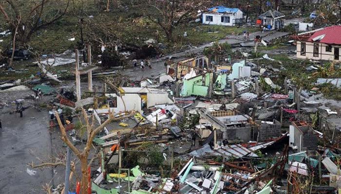
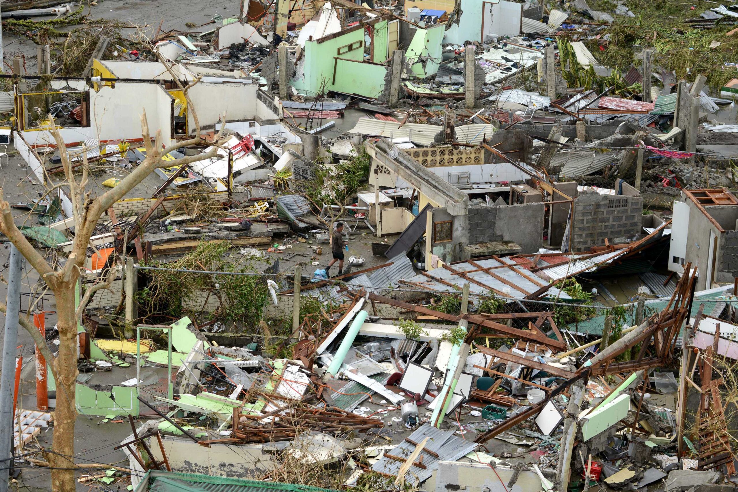
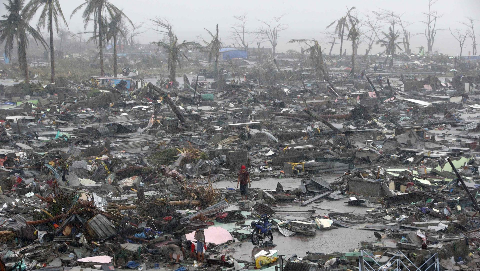
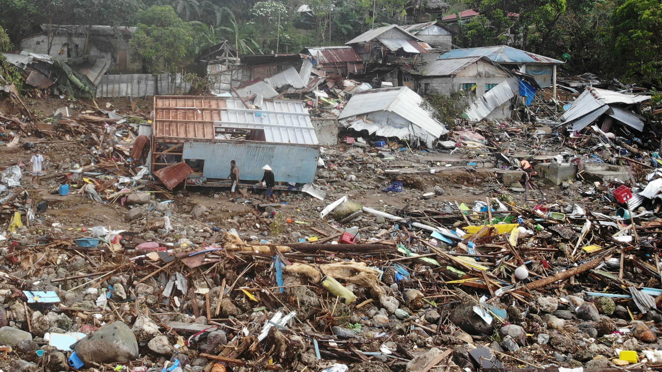
The typhoon caused catastrophic destruction in the Visayas, particularly in the islands of Samar and Leyte. According to UN officials, about 11 million people were affected and many were left homeless; many people are still missing as a result of this storm.[7]
Due to its extensive deaths and damages, the name Haiyan was retired in 2014 and replaced with Bailu. It was first used in the 2019 season.
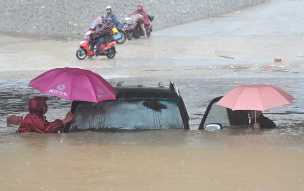
Southern China
The State Flood Control and Drought Relief Headquarters hoisted a level three emergency response in the provinces of Hainan, Guangdong and Guangxi. All fishing vessels were urged to return to ports by noon on November 9.[45] The Hong Kong Observatory issued the Strong Monsoon Signal at 19:10 HKT on November 9,[46] and it was still in place on November 13.[47]